You can expect wetter weather on and off through early next week


PORTLAND, Ore. (KOIN) — A second round of showers moved in along the coast and in the Willamette Valley on Wednesday night, a day after an ice storm caused thousands of power outages across the metro area.
KOIN 6 Meteorologist Kristen Van Dyke says the system will be a windy one, with gusts on the coast reaching 55 mph.
Winds will also pick up in the Portland metro area with gusts up to 30 mph overnight and even 40 mph on Thursday. This could bring down large branches and even some trees, so be careful out on the roads.
There will be a lull in the rain after morning with a round of heavy, blustery showers pushing in Thursday evening.
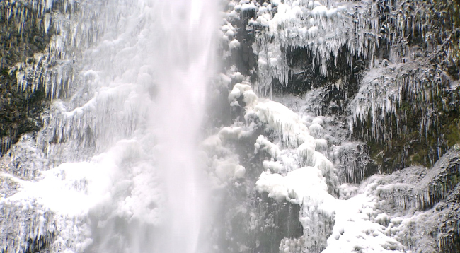
Freezing temperatures will mean more ice and freezing rain in the Gorge overnight and into Thursday. A rise in temperatures will scour out the cold air and turn the ice back into rain in the afternoon.
Thankfully, the ice will be confined to the Gorge as temperatures in the valley warm up to the 40s overnight.
You can expect wetter weather on and off through early next week. There’s no sunshine in our immediate future, but temperatures are expected to be much milder with highs in the 50s.
Keep the weather in your hand all the time — download the PDX Weather App today.
Check the latest Weather Alerts on the KOIN 6 Weather page
A second round of showers moved in along the coast and in the Willamette Valley on Wednesday night, a day after an ice storm caused thousands of power outages across the metro area.
Source: Gorge gets 2nd round of ice, blustery showers in PDX

Leave a comment